The Gulf of Carpentaria, Queensland, Australia is home to one of
the world's most extraordinary meteorological phenomenon. From late
September to early November, before the start of the rainy season,
the sky above Burketown in far North Queensland's Gulf of
Carpentaria, develops strange rolls of clouds called Morning
Glory.
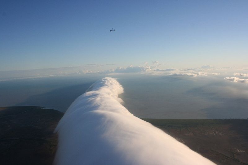
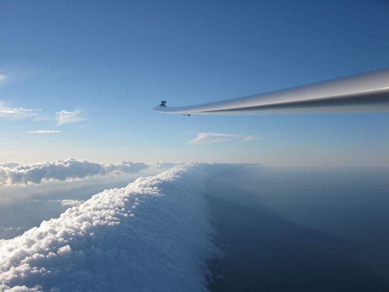
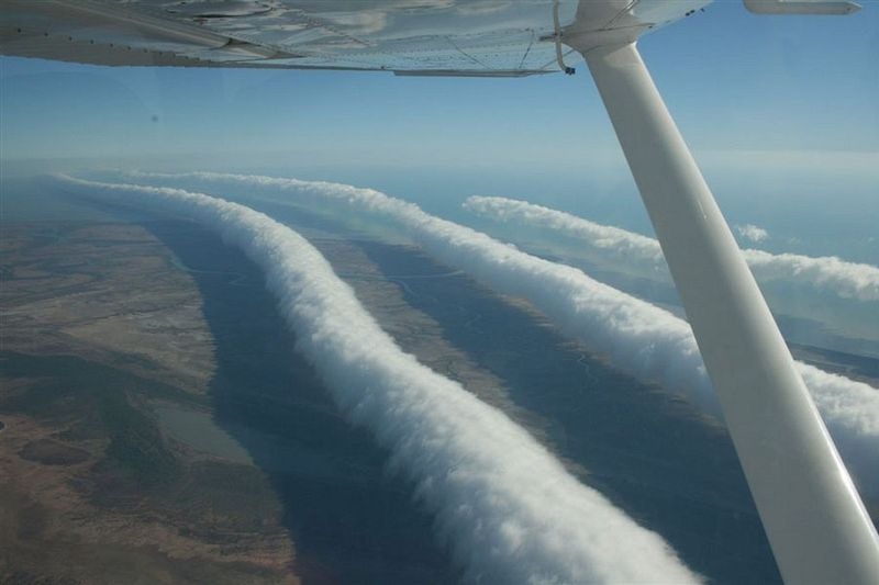
These clouds, that form in a series of bands, can be up to 1,000
km long and 2 km tall and often form only 100 to 200 meters above
the ground, attracting hang glider pilots who ride over it just as
a surfboard rider does on the ocean.
Morning Glory clouds are often accompanied by dangerous
turbulence such as sudden wind squalls, intense low-level wind
shear, rapid increase in the vertical displacement of air parcels,
and sharp pressure jump at the surface.
In the front of the cloud there is strong vertical upward motion
of the air, while the air behind the cloud sinks creating a rolling
effect. The clouds can achieve an airspeed of 60 kilometers per
hour over a surface with little discernible wind. Showers or
thunderstorms may also develop in its wake.
What causes Morning Glory cloud is not clearly understood, but
the particular configuration of the land and sea on the Cape York
Peninsula is believed to play a significant part in its
formation.
The peninsula tapers off from about 350 miles wide to 60 miles
as it extends north between the Gulf of Carpentaria to the west and
the Coral Sea to the east. During the day, the breeze from the
Coral Sea coast blows in from the east and the breeze from the gulf
blows in from the west.
The two breezes meet in the middle of the peninsula in the
evening, forcing the air to rise there and form a line of clouds
over the spine of the peninsula. When night comes, the air cools
and descends and at the same time a surface inversion (where air
temperature increases with height) forms over the gulf. The
densities in this stable layer are different above and below the
inversion.
The air descending from the peninsula to the east goes
underneath the inversion layer and this generates a series of waves
or rolling cylinders which travel across the gulf. These cylinders
of air roll along the underside of the inversion layer, so that the
air rises at the front of the wave and sinks at the rear.
In the early morning, the air is saturated enough so that the
rising air in the front produces a cloud, which forms the leading
edge of the cylinder, and evaporates in the back, hence forming the
Morning Glory cloud. The cloud lasts until the surface inversion
disappears with the heating of the day.

Morning Glory clouds have occasionally been observed elsewhere
such as central United States, the English Channel, Munich, Berlin,
eastern Russia, and other maritime regions of Australia. But the
Gulf of Carpentaria is the only known location where it can be
predicted and observed on a more or less regular basis